Long Cairns and Barrows
The first farmers (c 4,000 - 3,000 BC) buried some of their ancestors under edge-shaped or oval mounds of turf or stone, often sited on prominent hillcrests.
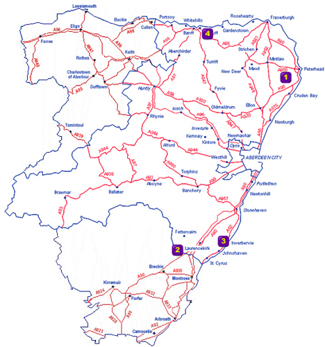
1. Cairn Catto
4 miles (6.4km) N of Cruden Bay just W of the minor road linking the A952 and the A950.
2. Capo
Within Capo Forestry Plantation, accessed via a footpath. On the W side of minor road leading to Edzell, about 1 mile (1.68km) from A90 at North Water Bridge.
3. Gourdon
0.3 miles (0.5km) S of Inverbervie on A92, access track on right. Walk about 0.8 miles (1.4km) up the track.
4. Longman Hill
Turn S off the A98 onto a minor road at Longmanhill Post Office to the first steading. Walk 250m up the field boundary to the crest of the hill.